The Pennine Way can be comfortably divided up into 17 day-long stages. According to wikipedia, the route includes 287 gates, 249 timber stiles, 183 stone stiles and 204 bridges; and the route provides 458 way marks. The total ascent on the Pennine Way is greater than the height of Mount Everest.
The exact stopping points will depend on the available accommodation.
Edale to Crowden (16 miles)
Starting out at the Old Nag’s Head public house in Edale, the trail begins with a steep climb up the stairs of Jacob’s Ladder to pass round the famous summits of Kinder Scout and Bleaklow, crossing the A57 Snake Road before reaching Torside Reservoir and Crowden. Andrew McCloy writes about this section that ‘There are tales of miserable, limping walkers throwing in the towel when they reach the A57, less than ten miles from the start at Edale, and wearily trudging the two and a half miles down the road to the Snake Pass Inn, or even west to Glossop. Others use the location to jettison unwanted items.’ This section is no longer the boggy, misty nightmare it was in the early days of the trail, thanks to extensive paving.
Kinder Scout is famous as the site of the Kinder Trespass, an important milestone in the campaign for a right to roam.
Crowden to Standedge (11 miles)
The second day is somewhat shorter than the first, beginning with a long climb up a valley, running alongside some large drops towards the top. From there, the route crosses Black Hill towards the A635, where there is sometimes a waiting food van. A series of reservoirs takes the route to the tiny village of Standedge, although more accommodation can be found a couple of miles away in Marsden.
Standedge to Calder Valley (14½ miles)
Day 3 continues over moorland, with views of Oldham and Manchester. If things are timed correctly, it is possible to stop for lunch at the White House Pub. This section includes the impressive monument at Stoodley Pike, above the town of Todmorden. Near the descent into the Calder Valley, walkers have the option of taking the Hebden Bridge Loop into the town. While Hebden Bridge was not part of the original Pennine Way, it’s earned its place as the birthplace of the Walkers are Welcome scheme. It’s a good place for a comfortable stay.
Calder Valley to Ickornshaw (15½ miles)
It’s a steep climb out of the Calder Valley and onto Heptonstall Moor. On the way up, the path passes through Colden - a short way off the way is May’s ‘Aladdin’s Cave’, which sells a variety of useful items. The path goes through Heptonstall, where there is a turn-off to the Packhorse Inn which is an excellent place for a stop. The path then passes some reservoirs until reaching the ruined farmhouse at Top Withens, incorrectly claimed as the model for Wuthering Heights. It’s possible to divert from here, via the Bronte waterfalls, to Haworth. Otherwise the route passes Ponden reservoir and Ponden Hall, said to be the model for Thrushcross Grange in Wuthering Heights. It then rises up the valley-side to Ickornshaw.
Ickornshaw to Malham (17 miles)
 |
|---|
| The Dalesman Cafe |
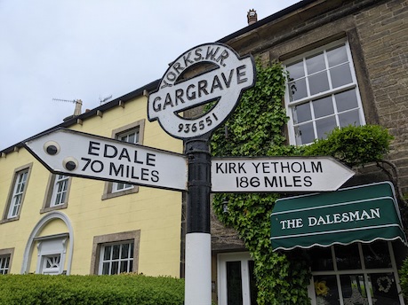
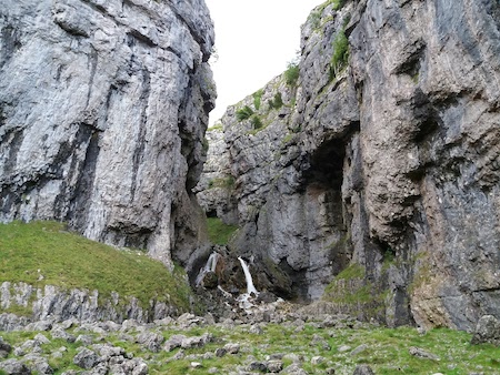
This section takes walkers from the Peak District to the Yorkshire Dales. The day’s route passes through a number of small villages: Lothersdale and Thornton-in-Craven, East Marston and Gargrave. From Lothersdale, the path climbs to Pinhaw Beacon from where Pen-y-ghent can be visible on a clear day. Gargrave includes the famous Dalesman Cafe. From here, the route continues to Malham. It’s worth taking the time while here to visit the impressive Gorsdale Scar.
 |
|---|
| Gorsdale Scar |
Malham to Horton-in-Ribblesdale (14½ miles)
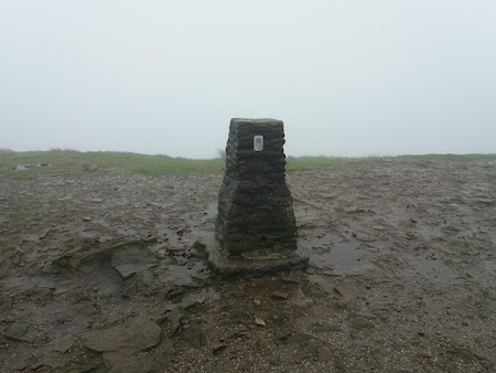
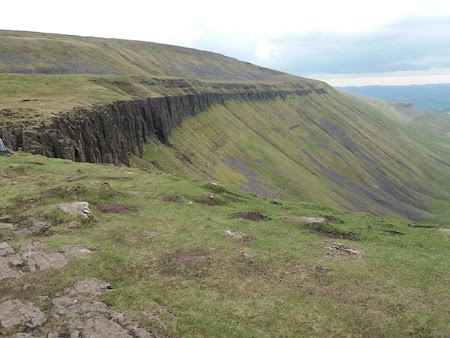
The sixth day begins with Malham Cove, one of the hightlights of the Pennine Way. Towards the end of the day is the ascent of Pen-y-ghent (696m/2283ft) before descending into the village of Horton-in-Ribblesdale.
 |
|---|
| The view from Penyghent can be poor |
Horton-in-Ribblesdale to Hawes (13½ miles)
A day of following long stone walls, with relatively little climbing to reach the bustling town of Hawes, home to the Wensleydale Creamery.
Hawes to Tan Hill (16 miles)
Immediately after Hawes is the village of Hardraw. Through the Green Dragon pub it’s possible to reach Hardraw Force waterfall, which is the highest single-drop waterfall in the UK. From there comes a climb to Great Shunner Fell, before descending into Thwaite. The path comes close to Keld, where it crosses the Coast-to-Coast path. There are good views of the Nine Standard before the route meets the isolated Tan Hill Inn (528m/1,732ft), the highest pub in the British Isles.
Tan Hill to Middleton-in-Teesdale (16½ miles)
The walk enters the North Pennines, passing through Sleightholme Moor. There is the option here of taking the Bowes loop for a break.
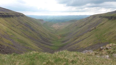
Middleton-in-Teesdale to Dufton (20 miles)
 |
|---|
| High Cup Nick |
This is by far my favourite section of the trail. The day begins by following the river Tees, with the impressive waterfalls at Low Force and High Force. There is a section below cliffs leading to another waterfall at Cauldron Snout. The day finishes with High Cup Nick, possibly one of the best views in England.
 |
|---|
| High Cup Nick |
Dufton to Alston
This section includes Cross Fell (893m/2,930ft), the highest point of the Pennine Way. The route passes Greg’s Hut, a bothy. The remainder of the day, however, is spent in a rather dreary stomp along a track until reaching the small village of Garrigil, a short way beyond which is Alston.
Alston to Greenhead
Much of this day is a riverside walk, with a great deal of stile-hopping, after which comes some boggy ground, which is only partially slabbed. From Black Hill, the route descends to Greenhead.
Greenhead to Bellingham
This section includes a rollercoaster of hills along Hadrian’s Wall before cutting north towards Scotland. Just before Bellingham comes Honeystead Farm where there is a pit-stop, providing shelter, kettle, and a fridge of soft drinks in return for a donation.
Bellingham to Byrness
A day of heather moorlands and forests before reaching the town of Byrness, which provided accommodation for forestry workers.
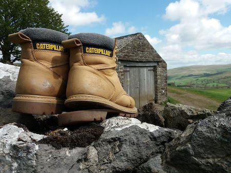
Byrness to Kirk Yetholm (2 day section)
The walk comes to an end with a stunning wild section through the Cheviots before descending to Kirk Yetholm on the Scottish border. As Wainwright wrote, “There is no brass band to greet you”, but you will be a better person because you have walked the Pennine Way. The walk ends at the Border Hotel, outside of which can be found abandoned, ruined boots.
 |
|---|
| Not every pair of boots makes it to the end |